 vesseltracker.com
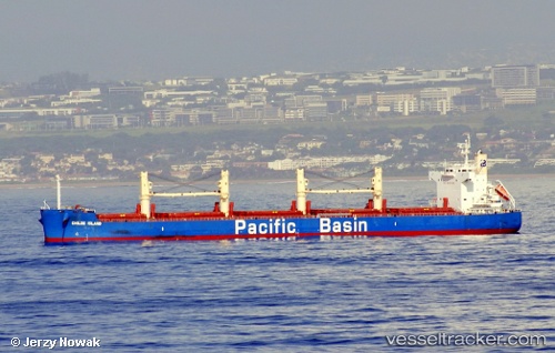
Chiloe Island
Current StatusWhere is the vessel?
Chiloe Island is currently in 117 nm NE of Sundance, based on AIS data received less than 1h ago.
Latest AIS update:
Current position: 24.92667° N, 133.34500° W (117 nm NE of Sundance)
Average speed (last 7 days): Loading…
Average speed (last 30 days): Loading…
Vessel profile: Chiloe Island is a Bulk Carrier with dimensions 32m x 190m.
This page combines live AIS, route history, probable destination signals, nearby traffic, and port activity for practical vessel monitoring.
The current position of vessel Chiloe Island is 24.92667 lat / -133.34500 lng. Updated: 2026-04-18 21:54:35 UTCDetails:
Live Vessel Chiloe Island Analytics (details, animations, etc.)
Recent AIS points (UTC):
2026-04-18 15:45:14 UTC · 25.09319, -134.59843 · SOG 11.1 kn · COG 93°2026-04-18 17:42:35 UTC · 25.05833, -134.19167 · SOG 11 kn · COG -1°
2026-04-18 20:12:35 UTC · 24.97833, -133.67833 · SOG 11 kn · COG -1°
2026-04-18 21:54:35 UTC · 24.92667, -133.34500 · SOG 10 kn · COG -1°