 vesseltracker.com
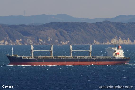
 Felicia K
Current Status
Where is the vessel?
Felicia K is currently in Near Wickham, based on AIS data received less than 1h ago.
Latest AIS update:
Current position: 32.89434° S, 151.77330° E (Near Wickham)
Average speed (last 7 days): Loading…
Average speed (last 30 days): Loading…
Vessel profile: Felicia K is a General Cargo Ship with dimensions 186m x 28m.
This page combines live AIS, route history, probable destination signals, nearby traffic, and port activity for practical vessel monitoring.
The current position of vessel Felicia K is -32.89434 lat / 151.77330 lng. Updated: 2026-04-13 13:27:31 UTCNearest reference points:
- Near Warners Bay
- Near Caves Beach
- Near BILGOLA PLATEAU
Currently sailing under the flag of Panama ![]()
Felicia K built in 2012 year
Deadweight:
32813 tDetails:
Live Vessel Felicia K Analytics (details, animations, etc.)
Recent AIS points (UTC):
2026-04-13 07:27:29 UTC · -32.89433, 151.77327 · SOG 0 kn · COG 7°2026-04-13 10:18:27 UTC · -32.89435, 151.77333 · SOG 0 kn · COG 7°
2026-04-13 11:24:28 UTC · -32.89434, 151.77328 · SOG 0 kn · COG 7°
2026-04-13 13:27:31 UTC · -32.89434, 151.77330 · SOG 0 kn · COG 7°