 vesseltracker.com
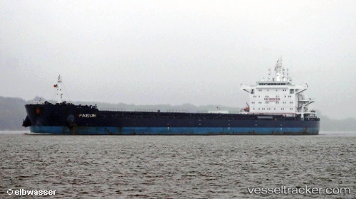
 Pabur
Pabur
Current Status
Where is the vessel?
Pabur is currently in 217 nm SE of Diego Garcia, based on AIS data received about 1h ago.
Latest AIS update:
Current position: 9.16550° S, 75.59880° E (217 nm SE of Diego Garcia)
Average speed (last 7 days): Loading…
Average speed (last 30 days): Loading…
Vessel profile: Pabur is a Bulk Carrier with dimensions 225m x 32m.
This page combines live AIS, route history, probable destination signals, nearby traffic, and port activity for practical vessel monitoring.
The current position of vessel Pabur is -9.16550 lat / 75.59880 lng. Updated: 2026-04-19 19:52:13 UTCNearest reference points:
- 208 nm E of Diego Garcia
- 284 nm E of Diego Garcia
- 253 nm S of Diego Garcia
Currently sailing under the flag of Antigua Barbuda ![]()
Pabur built in 2012 year
Deadweight:
75426 tDetails:
Live Vessel Pabur Analytics (details, animations, etc.)
Recent AIS points (UTC):
2026-04-19 16:53:08 UTC · -9.47233, 75.20718 · SOG 10.1 kn · COG 51°2026-04-19 18:18:06 UTC · -9.32667, 75.39333 · SOG 10 kn · COG -1°
2026-04-19 19:52:13 UTC · -9.16550, 75.59880 · SOG 10 kn · COG 51°
2026-04-19 19:52:13 UTC · -9.16550, 75.59880 · SOG 10 kn · COG 51°