 vesseltracker.com
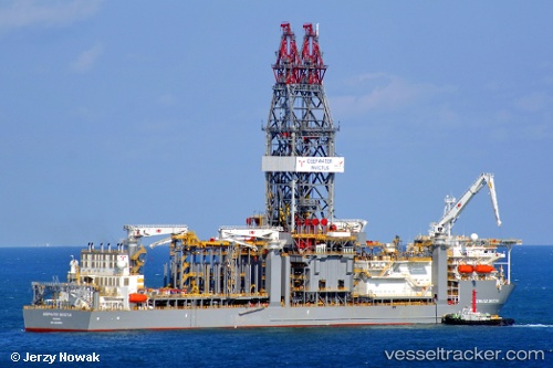
 Deepwater Invictus
Current Status
Where is the vessel?
Deepwater Invictus is currently in 115 nm SW of Gulfmex Lightering Area, based on AIS data received less than 1h ago.
Latest AIS update:
Current position: 26.70167° N, 92.63833° W (115 nm SW of Gulfmex Lightering Area)
Average speed (last 7 days): Loading…
Average speed (last 30 days): Loading…
Vessel profile: Deepwater Invictus is a Drilling Ship with dimensions 238m x 42m.
This page combines live AIS, route history, probable destination signals, nearby traffic, and port activity for practical vessel monitoring.
The current position of vessel Deepwater Invictus is 26.70167 lat / -92.63833 lng. Updated: 2026-04-17 07:52:37 UTCNearest reference points:
- 124 nm SW of Gulfmex Lightering Area
- 83 nm W of Gulfmex Lightering Area
- 97 nm W of Gulfmex Lightering Area
Currently sailing under the flag of Marshall Is ![]()
Details:
Live Vessel Deepwater Invictus Analytics (details, animations, etc.)
Recent AIS points (UTC):
2026-04-17 01:40:40 UTC · 26.70167, -92.63833 · SOG 0 kn · COG -1°2026-04-17 03:46:38 UTC · 26.70167, -92.63833 · SOG 0 kn · COG -1°
2026-04-17 06:01:50 UTC · 26.70167, -92.63833 · SOG 0 kn · COG -1°
2026-04-17 07:52:37 UTC · 26.70167, -92.63833 · SOG 0 kn · COG -1°