 vesseltracker.com
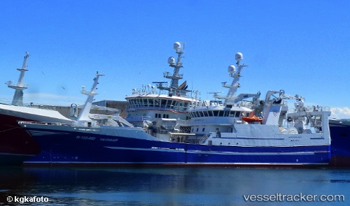
 Havsnurp
Current Status
Where is the vessel?
Havsnurp is currently in Near Averøy, based on AIS data received less than 1h ago.
Latest AIS update:
Current position: 63.04624° N, 7.51034° E (Near Averøy)
Average speed (last 7 days): Loading…
Average speed (last 30 days): Loading…
Vessel profile: Havsnurp is a Fish Carrier with dimensions 63m x 63m.
This page combines live AIS, route history, probable destination signals, nearby traffic, and port activity for practical vessel monitoring.
The current position of vessel Havsnurp is 63.04624 lat / 7.51034 lng. Updated: 2026-04-16 20:15:22 UTCNearest reference points:
- Near ELNESVAGEN
- Near Kristiansund
- Near Smøla
Currently sailing under the flag of Norway ![]()
Havsnurp built in 2012 year
Deadweight:
1700 tDetails:
Live Vessel Havsnurp Analytics (details, animations, etc.)
Recent AIS points (UTC):
2026-04-16 11:31:38 UTC · 63.04618, 7.51024 · SOG 0 kn · COG 247°2026-04-16 13:23:22 UTC · 63.04619, 7.51024 · SOG 0 kn · COG 246°
2026-04-16 16:19:52 UTC · 63.04626, 7.51025 · SOG 0 kn · COG 246°
2026-04-16 20:15:22 UTC · 63.04624, 7.51034 · SOG 0 kn · COG 247°