 vesseltracker.com
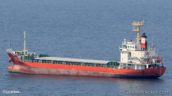
 Kara
Kara
Current Status
Where is the vessel?
Kara is currently in 27 nm SW of HAMAJIMA, based on AIS data received about 1h ago.
Latest AIS update:
Current position: 33.90169° N, 136.50520° E (27 nm SW of HAMAJIMA)
Average speed (last 7 days): Loading…
Average speed (last 30 days): Loading…
Vessel profile: Kara is a General Cargo Ship with dimensions 79m x 14m.
This page combines live AIS, route history, probable destination signals, nearby traffic, and port activity for practical vessel monitoring.
The current position of vessel Kara is 33.90169 lat / 136.50520 lng. Updated: 2026-04-20 16:50:00 UTCNearest reference points:
- 20 nm S of HAMAJIMA
- Near TOBA
- 12 nm E of TOBA
Currently sailing under the flag of Korea ![]()
Details:
Live Vessel Kara Analytics (details, animations, etc.)
Recent AIS points (UTC):
2026-04-20 13:46:10 UTC · 33.57174, 136.04794 · SOG 9.8 kn · COG 50°2026-04-20 14:24:39 UTC · 33.64328, 136.14046 · SOG 9.6 kn · COG 45°
2026-04-20 16:24:39 UTC · 33.86008, 136.43456 · SOG 9.9 kn · COG 51°
2026-04-20 16:50:00 UTC · 33.90169, 136.50520 · SOG 10.2 kn · COG 50°