 vesseltracker.com
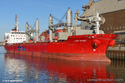
 Lady Demet
Current Status
Where is the vessel?
Lady Demet is currently in Near Bayuquan, based on AIS data received about 1h ago.
Latest AIS update:
Current position: 40.29247° N, 122.09336° E (Near Bayuquan)
Average speed (last 7 days): Loading…
Average speed (last 30 days): Loading…
Vessel profile: Lady Demet is a Bulk Carrier with dimensions 178m x 178m.
This page combines live AIS, route history, probable destination signals, nearby traffic, and port activity for practical vessel monitoring.
The current position of vessel Lady Demet is 40.29247 lat / 122.09336 lng. Updated: 2026-04-20 00:15:28 UTCNearest reference points:
- Near Bayuquan
- 15 nm W of Bayuquan
- 17 nm SW of PANJIN
Currently sailing under the flag of Marshall Is ![]()
Lady Demet built in 2012 year
Deadweight:
30124 tDetails:
Live Vessel Lady Demet Analytics (details, animations, etc.)
Recent AIS points (UTC):
2026-04-19 19:30:19 UTC · 40.29249, 122.09338 · SOG 0.1 kn · COG 153°2026-04-19 21:36:24 UTC · 40.29250, 122.09341 · SOG 0.1 kn · COG 153°
2026-04-19 22:15:24 UTC · 40.29247, 122.09338 · SOG 0.1 kn · COG 153°
2026-04-20 00:15:28 UTC · 40.29247, 122.09336 · SOG 0.1 kn · COG 153°