 vesseltracker.com
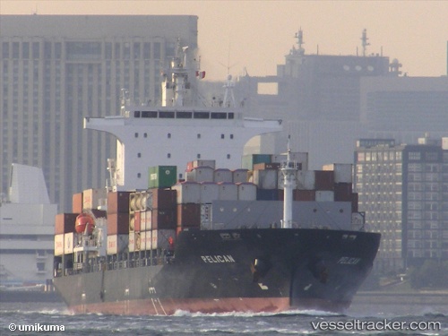
 Pelican
Current Status
Where is the vessel?
Pelican is currently in Near Pazundaung, based on AIS data received about 7h ago.
Latest AIS update:
Current position: 16.79667° N, 96.11833° E (Near Pazundaung)
Average speed (last 7 days): Loading…
Average speed (last 30 days): Loading…
Vessel profile: Pelican is a Container Ship with dimensions 172m x 27m.
This page combines live AIS, route history, probable destination signals, nearby traffic, and port activity for practical vessel monitoring.
The current position of vessel Pelican is 16.79667 lat / 96.11833 lng. Updated: 2026-04-18 02:55:25 UTCNearest reference points:
- Near Thilawa
- 80 nm SW of Sangkhla Buri Customs House
Currently sailing under the flag of Liberia ![]()
Pelican built in 2013 year
Deadweight:
22071 tDetails:
Live Vessel Pelican Analytics (details, animations, etc.)
Recent AIS points (UTC):
2026-04-18 00:00:20 UTC · 16.79667, 96.11833 · SOG 0 kn · COG -1°2026-04-18 02:55:25 UTC · 16.79667, 96.11833 · SOG 0 kn · COG -1°
2026-04-18 02:55:25 UTC · 16.79667, 96.11833 · SOG 0 kn · COG -1°
2026-04-18 02:55:25 UTC · 16.79667, 96.11833 · SOG 0 kn · COG -1°