 vesseltracker.com
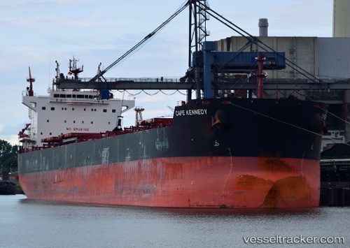
Cape Kennedy
Current StatusWhere is the vessel?
Cape Kennedy is currently in Near Paranagua, based on AIS data received less than 1h ago.
Latest AIS update:
Current position: 25.50182° S, 48.50835° W (Near Paranagua)
Average speed (last 7 days): Loading…
Average speed (last 30 days): Loading…
Vessel profile: Cape Kennedy is a Bulk Carrier with dimensions 32m x 229m.
This page combines live AIS, route history, probable destination signals, nearby traffic, and port activity for practical vessel monitoring.
The current position of vessel Cape Kennedy is -25.50182 lat / -48.50835 lng. Updated: 2026-04-14 17:33:42 UTCNearest reference points:
- 24 nm E of Caioba
- 32 nm E of Caioba
- 10 nm NE of CAMBORIU
Details:
Live Vessel Cape Kennedy Analytics (details, animations, etc.)
Recent AIS points (UTC):
2026-04-14 12:21:40 UTC · -25.50572, -48.41415 · SOG 0.2 kn · COG 122°2026-04-14 13:33:39 UTC · -25.50591, -48.41449 · SOG 0.1 kn · COG 111°
2026-04-14 16:25:50 UTC · -25.49548, -48.49287 · SOG 5.5 kn · COG 259°
2026-04-14 17:33:42 UTC · -25.50182, -48.50835 · SOG 0 kn · COG 262°