 vesseltracker.com
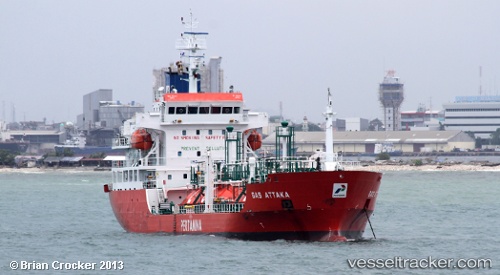
Gas Attaka
Current StatusWhere is the vessel?
Gas Attaka is currently in 33 nm SW of MANADO, based on AIS data received about 17h ago.
Latest AIS update:
Current position: 1.17833° N, 124.37833° E (33 nm SW of MANADO)
Average speed (last 7 days): Loading…
Average speed (last 30 days): Loading…
Vessel profile: Gas Attaka is a Lpg Tanker with dimensions 17m x 99m.
This page combines live AIS, route history, probable destination signals, nearby traffic, and port activity for practical vessel monitoring.
The current position of vessel Gas Attaka is 1.17833 lat / 124.37833 lng. Updated: 2026-03-26 05:38:22 UTCNearest reference points:
- Near BITUNG
- Near Tangkiang
Details:
Live Vessel Gas Attaka Analytics (details, animations, etc.)
Recent AIS points (UTC):
2026-03-26 05:23:21 UTC · 1.18333, 124.36833 · SOG 2 kn · COG -1°2026-03-26 05:38:22 UTC · 1.17833, 124.37833 · SOG 1 kn · COG -1°
2026-03-26 05:38:22 UTC · 1.17833, 124.37833 · SOG 1 kn · COG -1°
2026-03-26 05:38:22 UTC · 1.17833, 124.37833 · SOG 1 kn · COG -1°