 vesseltracker.com
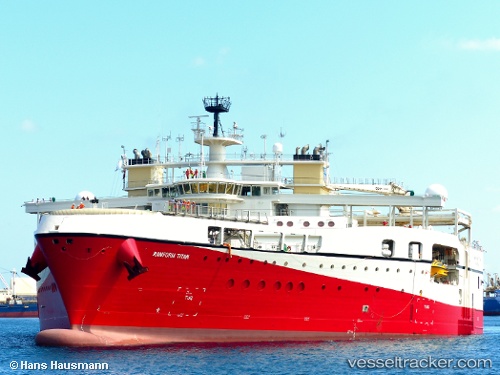
 RAMFORM TITAN
Current Status
Where is the vessel?
RAMFORM TITAN is currently in 92 nm E of Imbituba, based on AIS data received about 1h ago.
Latest AIS update:
Current position: 28.13683° S, 46.89501° W (92 nm E of Imbituba)
Average speed (last 7 days): Loading…
Average speed (last 30 days): Loading…
Vessel profile: RAMFORM TITAN is a Research/Survey Vessel with dimensions m x m.
This page combines live AIS, route history, probable destination signals, nearby traffic, and port activity for practical vessel monitoring.
The current position of vessel RAMFORM TITAN is -28.13683 lat / -46.89501 lng. Updated: 2026-04-14 23:51:42 UTCNearest reference points:
- 138 nm E of Imbituba
- 14 nm SE of Imbituba
- 15 nm SE of Imbituba
Currently sailing under the flag of Bahamas ![]()
Details:
Live Vessel RAMFORM TITAN Analytics (details, animations, etc.)
Recent AIS points (UTC):
2026-04-14 17:30:21 UTC · -28.20944, -47.19238 · SOG 4.5 kn · COG 1°2026-04-14 18:39:22 UTC · -28.13597, -47.18133 · SOG 3.1 kn · COG 22°
2026-04-14 21:57:03 UTC · -28.05313, -47.02598 · SOG 4.5 kn · COG 111°
2026-04-14 23:51:42 UTC · -28.13683, -46.89501 · SOG 4.6 kn · COG 130°