 vesseltracker.com
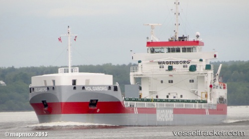
 Volgaborg
Current Status
Where is the vessel?
Volgaborg is currently in Near SKAGEN, based on AIS data received less than 1h ago.
Latest AIS update:
Current position: 57.64598° N, 10.62108° E (Near SKAGEN)
Average speed (last 7 days): Loading…
Average speed (last 30 days): Loading…
Vessel profile: Volgaborg is a General Cargo Ship with dimensions 143m x 143m.
This page combines live AIS, route history, probable destination signals, nearby traffic, and port activity for practical vessel monitoring.
The current position of vessel Volgaborg is 57.64598 lat / 10.62108 lng. Updated: 2026-04-05 16:08:05 UTCNearest reference points:
- Near SKAGEN
- Near Frederikshavn
- 19 nm E of Sæby
Currently sailing under the flag of Netherlands ![]()
Volgaborg built in 2013 year
Deadweight:
11850 tDetails:
Live Vessel Volgaborg Analytics (details, animations, etc.)
Recent AIS points (UTC):
2026-04-05 09:43:43 UTC · 57.64678, 10.61970 · SOG 0.8 kn · COG 216°2026-04-05 12:04:43 UTC · 57.64647, 10.62055 · SOG 1 kn · COG 227°
2026-04-05 14:23:06 UTC · 57.64635, 10.62078 · SOG 0.9 kn · COG 218°
2026-04-05 16:08:05 UTC · 57.64598, 10.62108 · SOG 0.6 kn · COG 260°