 vesseltracker.com
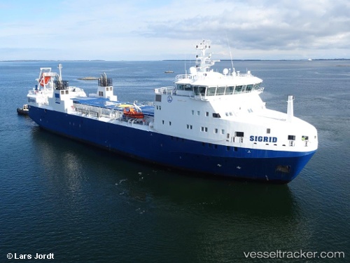
 Sigrid
Current Status
Where is the vessel?
Sigrid is currently in Near Simpevarp, based on AIS data received about 2h ago.
Latest AIS update:
Current position: 57.40958° N, 16.67559° E (Near Simpevarp)
Average speed (last 7 days): Loading…
Average speed (last 30 days): Loading…
Vessel profile: Sigrid is a Nuclear Fuel Carrier with dimensions 99m x 18m.
This page combines live AIS, route history, probable destination signals, nearby traffic, and port activity for practical vessel monitoring.
The current position of vessel Sigrid is 57.40958 lat / 16.67559 lng. Updated: 2026-04-17 05:33:59 UTCNearest reference points:
- Near Krokek
- Near Karlskrona
- Near RONNEBY
Currently sailing under the flag of Sweden ![]()
Sigrid built in 2013 year
Deadweight:
1600 tDetails:
Live Vessel Sigrid Analytics (details, animations, etc.)
Recent AIS points (UTC):
2026-04-16 23:25:00 UTC · 57.40959, 16.67560 · SOG 0 kn · COG 210°2026-04-17 02:34:00 UTC · 57.40959, 16.67559 · SOG 0 kn · COG 210°
2026-04-17 03:42:59 UTC · 57.40959, 16.67559 · SOG 0 kn · COG 210°
2026-04-17 05:33:59 UTC · 57.40958, 16.67559 · SOG 0 kn · COG 210°