 vesseltracker.com
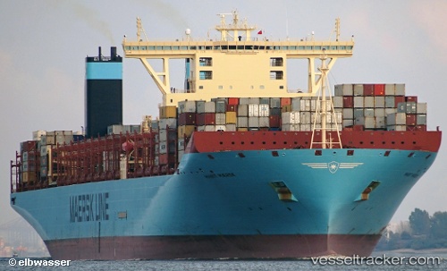
Marit Maersk
Current StatusWhere is the vessel?
Marit Maersk is currently in Open sea, approx. 466 nm off the nearest listed port, based on AIS data received about 3h ago.
Latest AIS update:
Current position: 6.15947° S, 4.77417° W (Open sea, approx. 466 nm off the nearest listed port)
Average speed (last 7 days): Loading…
Average speed (last 30 days): Loading…
Vessel profile: Marit Maersk is a Container Ship with dimensions 60m x 399m.
This page combines live AIS, route history, probable destination signals, nearby traffic, and port activity for practical vessel monitoring.
The current position of vessel Marit Maersk is -6.15947 lat / -4.77417 lng. Updated: 2026-04-08 16:00:33 UTCNearest reference points:
- Open sea, approx. 466 nm off the nearest listed port
- Open sea, approx. 467 nm off the nearest listed port
- Open sea, approx. 464 nm off the nearest listed port
Details:
Live Vessel Marit Maersk Analytics (details, animations, etc.)
Recent AIS points (UTC):
2026-04-08 11:46:19 UTC · -7.27667, -3.92667 · SOG 20 kn · COG -1°2026-04-08 14:10:54 UTC · -6.64410, -4.40420 · SOG 19.9 kn · COG 323°
2026-04-08 16:00:33 UTC · -6.15947, -4.77417 · SOG 19.7 kn · COG 323°
2026-04-08 16:00:33 UTC · -6.15947, -4.77417 · SOG 19.7 kn · COG 323°