 vesseltracker.com
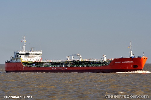
Vessel ZUMRUT ANA IMO: 9633549, MMSI: 636093028 Chemical Oil Products Tanker
UTC, 45.31753, 29.80367, course: 326, speed: 7.2
UTC, 45.31753, 29.80367, course: 326, speed: 7.2
2026-03-16 05:53:08 UTC, 45.31753, 29.80367, course: 326, speed: 7.2
Live Vessel ZUMRUT ANA Analytics (details, animations, etc.)
Live AIS position: UTC. Near Ust-Dunaisk/Vylkove), updated 2026-03-16 05:53:08 UTC.Find the position of the vessel ZUMRUT ANA on the map. The latter are known coordinates and path.
marine traffic ship tracker show on live map
The current position of vessel ZUMRUT ANA is 45.31753 lat / 29.80367 lng. Updated: 2026-03-16 05:53:08 UTCCurrently sailing under the flag of Liberia
ZUMRUT ANA built in 2014 year
Deadweight:
7110 tDetails:
Last coordinates of the vessel:
UTC, 45.26697, 29.81330, course: 6, speed: 7.2UTC, 45.31753, 29.80367, course: 326, speed: 7.2
UTC, 45.31753, 29.80367, course: 326, speed: 7.2
2026-03-16 05:53:08 UTC, 45.31753, 29.80367, course: 326, speed: 7.2