 vesseltracker.com
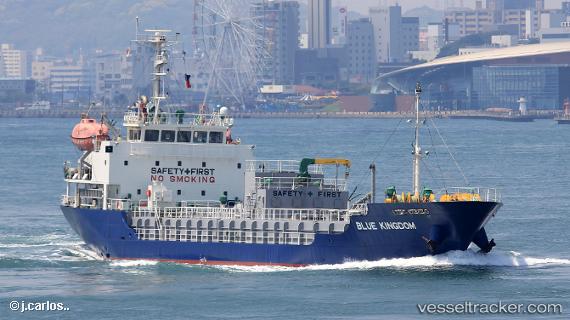
Blue Kingdom
Current StatusWhere is the vessel?
Blue Kingdom is currently in Near HIRAHATA, based on AIS data received about 1h ago.
Latest AIS update:
Current position: 34.76685° N, 134.57176° E (Near HIRAHATA)
Average speed (last 7 days): Loading…
Average speed (last 30 days): Loading…
Vessel profile: Blue Kingdom is a Bitumen Tanker with dimensions 13m x 80m.
This page combines live AIS, route history, probable destination signals, nearby traffic, and port activity for practical vessel monitoring.
The current position of vessel Blue Kingdom is 34.76685 lat / 134.57176 lng. Updated: 2026-04-22 13:55:35 UTCNearest reference points:
- Near AIOI
- Near HINASE
- Near KAKOGAWA
Details:
Live Vessel Blue Kingdom Analytics (details, animations, etc.)
Recent AIS points (UTC):
2026-04-22 10:20:04 UTC · 34.76686, 134.57172 · SOG 0.1 kn · COG 191°2026-04-22 12:22:34 UTC · 34.76696, 134.57178 · SOG 0 kn · COG 191°
2026-04-22 13:35:43 UTC · 34.76686, 134.57175 · SOG 0.1 kn · COG 191°
2026-04-22 13:55:35 UTC · 34.76685, 134.57176 · SOG 0.1 kn · COG 191°