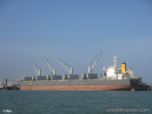
 HTK MIGHTY
Current Status
Where is the vessel?
HTK MIGHTY is currently in 81 nm W of Moratuwa, based on AIS data received about 14h ago.
Latest AIS update:
Current position: 6.46044° N, 78.54137° E (81 nm W of Moratuwa)
Average speed (last 7 days): Loading…
Average speed (last 30 days): Loading…
Vessel profile: HTK MIGHTY is a Bulk Carrier with dimensions m x m.
This page combines live AIS, route history, probable destination signals, nearby traffic, and port activity for practical vessel monitoring.
The current position of vessel HTK MIGHTY is 6.46044 lat / 78.54137 lng. Updated: 2026-05-23 11:44:46 UTCNearest reference points:
- 90 nm W of Moratuwa
- 82 nm W of Moratuwa
- 94 nm W of Dehiwala
Currently sailing under the flag of Panama ![]()
Details:
Live Vessel HTK MIGHTY Analytics (details, animations, etc.)
Recent AIS points (UTC):
2026-05-23 07:42:46 UTC · 6.79667, 77.80500 · SOG 11 kn · COG -1°2026-05-23 09:59:47 UTC · 6.60246, 78.21877 · SOG 11.9 kn · COG 111°
2026-05-23 10:04:46 UTC · 6.59572, 78.23398 · SOG 11.8 kn · COG 112°
2026-05-23 11:44:46 UTC · 6.46044, 78.54137 · SOG 11.8 kn · COG 111°