 vesseltracker.com
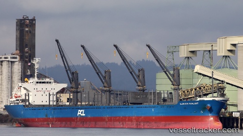
 AGALI
AGALI
Current Status
Where is the vessel?
AGALI is currently in Near RATHLIN ISLAND, based on AIS data received about 107d ago.
Latest AIS update:
Current position: 55.34215° N, 6.33243° W (Near RATHLIN ISLAND)
Average speed (last 7 days): Loading…
Average speed (last 30 days): Loading…
Vessel profile: AGALI is a Bulk Carrier with dimensions 27m x 170m.
This page combines live AIS, route history, probable destination signals, nearby traffic, and port activity for practical vessel monitoring.
The current position of vessel AGALI is 55.34215 lat / -6.33243 lng. Updated: 2025-12-09 05:35:30 UTCNearest reference points:
- Near Belfast
- Near Campbeltown
- Near Southend
Currently sailing under the flag of Bahamas ![]()
AGALI built in 2013 year
Deadweight:
28202 tDetails:
Live Vessel AGALI Analytics (details, animations, etc.)
Recent AIS points (UTC):
2025-12-09 05:35:30 UTC · 55.34215, -6.33243 · SOG 8 kn · COG 80°