 vesseltracker.com
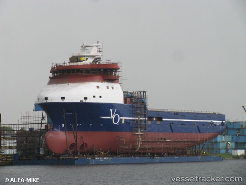
 REM CETUS
Current Status
Where is the vessel?
REM CETUS is currently in 22 nm W of Etrick Field, based on AIS data received less than 1h ago.
Latest AIS update:
Current position: 57.82095° N, 1.26294° W (22 nm W of Etrick Field)
Average speed (last 7 days): Loading…
Average speed (last 30 days): Loading…
Vessel profile: REM CETUS is a Offshore Supply Ship with dimensions m x m.
This page combines live AIS, route history, probable destination signals, nearby traffic, and port activity for practical vessel monitoring.
The current position of vessel REM CETUS is 57.82095 lat / -1.26294 lng. Updated: 2026-03-30 22:01:49 UTCNearest reference points:
- Near Peterhead
- Near PETERHEAD
- Near Aberdeen
Currently sailing under the flag of Cyprus ![]()
Details:
Live Vessel REM CETUS Analytics (details, animations, etc.)
Recent AIS points (UTC):
2026-03-30 15:47:48 UTC · 57.14021, -2.08019 · SOG 1 kn · COG 266°2026-03-30 17:29:39 UTC · 57.33665, -1.81099 · SOG 9.1 kn · COG 27°
2026-03-30 19:31:20 UTC · 57.56271, -1.55689 · SOG 7.2 kn · COG 24°
2026-03-30 22:01:49 UTC · 57.82095, -1.26294 · SOG 6.7 kn · COG 19°