 vesseltracker.com
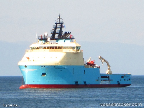
 Maersk Clipper
Current Status
Where is the vessel?
Maersk Clipper is currently in 77 nm W of White Rose Field, based on AIS data received less than 1h ago.
Latest AIS update:
Current position: 46.93333° N, 49.86500° W (77 nm W of White Rose Field)
Average speed (last 7 days): Loading…
Average speed (last 30 days): Loading…
Vessel profile: Maersk Clipper is a Offshore Tug Supply Ship with dimensions 80m x 22m.
This page combines live AIS, route history, probable destination signals, nearby traffic, and port activity for practical vessel monitoring.
The current position of vessel Maersk Clipper is 46.93333 lat / -49.86500 lng. Updated: 2026-04-12 20:03:56 UTCNearest reference points:
- 24 nm SW of White Rose Field
Currently sailing under the flag of Canada ![]()
Details:
Live Vessel Maersk Clipper Analytics (details, animations, etc.)
Recent AIS points (UTC):
2026-04-12 13:59:44 UTC · 46.48167, -48.48833 · SOG 6 kn · COG -1°2026-04-12 16:18:00 UTC · 46.64813, -49.01132 · SOG 10.9 kn · COG 293°
2026-04-12 17:41:04 UTC · 46.75669, -49.33434 · SOG 10.6 kn · COG 293°
2026-04-12 20:03:56 UTC · 46.93333, -49.86500 · SOG 10 kn · COG -1°