 vesseltracker.com
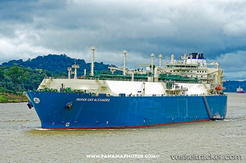
Maran Gas Alexandria
Current StatusWhere is the vessel?
Maran Gas Alexandria is currently in 112 nm E of Marsh Harbour, based on AIS data received less than 1h ago.
Latest AIS update:
Current position: 26.74766° N, 74.88555° W (112 nm E of Marsh Harbour)
Average speed (last 7 days): Loading…
Average speed (last 30 days): Loading…
Vessel profile: Maran Gas Alexandria is a Lng Tanker with dimensions 45m x 289m.
This page combines live AIS, route history, probable destination signals, nearby traffic, and port activity for practical vessel monitoring.
The current position of vessel Maran Gas Alexandria is 26.74766 lat / -74.88555 lng. Updated: 2026-04-03 19:43:05 UTCNearest reference points:
- 31 nm E of Harbour Island
- 22 nm E of Harbour Island
- Near Harbour Island
Details:
Live Vessel Maran Gas Alexandria Analytics (details, animations, etc.)
Recent AIS points (UTC):
2026-04-03 13:58:26 UTC · 27.30502, -73.63405 · SOG 13.5 kn · COG -1°2026-04-03 14:54:00 UTC · 27.21224, -73.83657 · SOG 12.7 kn · COG -1°
2026-04-03 17:11:24 UTC · 26.99246, -74.32894 · SOG 12.9 kn · COG 245°
2026-04-03 19:43:05 UTC · 26.74766, -74.88555 · SOG 13.2 kn · COG 239°