 vesseltracker.com
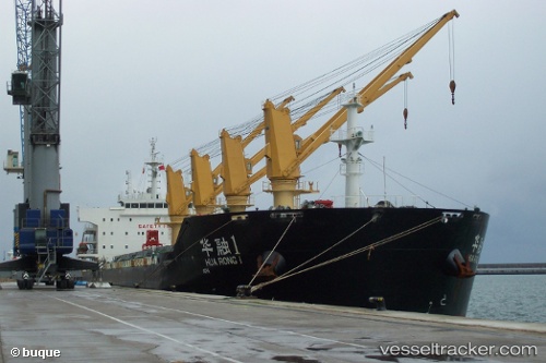
 Hua Rong 1
Current Status
Where is the vessel?
Hua Rong 1 is currently in 57 nm S of Shapa, based on AIS data received about 2h ago.
Latest AIS update:
Current position: 20.60167° N, 111.83167° E (57 nm S of Shapa)
Average speed (last 7 days): Loading…
Average speed (last 30 days): Loading…
Vessel profile: Hua Rong 1 is a Bulk Carrier with dimensions 189m x 32m.
This page combines live AIS, route history, probable destination signals, nearby traffic, and port activity for practical vessel monitoring.
The current position of vessel Hua Rong 1 is 20.60167 lat / 111.83167 lng. Updated: 2026-03-28 13:45:59 UTCNearest reference points:
- 46 nm S of Zhapo
- 57 nm NE of Honghai
- 28 nm SE of Shapa
Currently sailing under the flag of China ![]()
Hua Rong 1 built in 2012 year
Deadweight:
56381 tDetails:
Live Vessel Hua Rong 1 Analytics (details, animations, etc.)
Recent AIS points (UTC):
2026-03-28 07:34:09 UTC · 21.66097, 111.81923 · SOG 8.6 kn · COG 195°2026-03-28 10:23:10 UTC · 21.21192, 111.78187 · SOG 10.7 kn · COG 176°
2026-03-28 12:11:28 UTC · 20.88234, 111.78060 · SOG 10 kn · COG 185°
2026-03-28 13:45:59 UTC · 20.60167, 111.83167 · SOG 11 kn · COG -1°