 vesseltracker.com
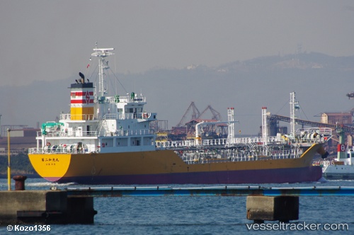
 Wakomaru No.2
Current Status
Where is the vessel?
Wakomaru No.2 is currently in Near KIKUMA, based on AIS data received about 2h ago.
Latest AIS update:
Current position: 34.05038° N, 132.84195° E (Near KIKUMA)
Average speed (last 7 days): Loading…
Average speed (last 30 days): Loading…
Vessel profile: Wakomaru No.2 is a Oil Products Tanker with dimensions 90m x 14m.
This page combines live AIS, route history, probable destination signals, nearby traffic, and port activity for practical vessel monitoring.
The current position of vessel Wakomaru No.2 is 34.05038 lat / 132.84195 lng. Updated: 2026-04-19 21:51:36 UTCNearest reference points:
- Near Yoshiumi
- Near TSUWAJI
- Near Kure
Currently sailing under the flag of Japan ![]()
Details:
Live Vessel Wakomaru No.2 Analytics (details, animations, etc.)
Recent AIS points (UTC):
2026-04-19 19:18:37 UTC · 34.05043, 132.84172 · SOG 0.1 kn · COG 52°2026-04-19 19:33:37 UTC · 34.05046, 132.84171 · SOG 0.1 kn · COG 58°
2026-04-19 21:30:38 UTC · 34.05050, 132.84181 · SOG 0.1 kn · COG 57°
2026-04-19 21:51:36 UTC · 34.05038, 132.84195 · SOG 0 kn · COG 35°