 vesseltracker.com
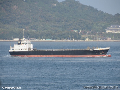
 Kashii
Current Status
Where is the vessel?
Kashii is currently in Near Kobe, based on AIS data received about 2h ago.
Latest AIS update:
Current position: 34.66731° N, 135.18633° E (Near Kobe)
Average speed (last 7 days): Loading…
Average speed (last 30 days): Loading…
Vessel profile: Kashii is a General Cargo Ship with dimensions 84m x 13m.
This page combines live AIS, route history, probable destination signals, nearby traffic, and port activity for practical vessel monitoring.
The current position of vessel Kashii is 34.66731 lat / 135.18633 lng. Updated: 2026-03-27 03:54:36 UTCNearest reference points:
- Near Kobe
- Near Hyogo
- Near Nada-Ku, Hyogo
Currently sailing under the flag of Japan ![]()
Details:
Live Vessel Kashii Analytics (details, animations, etc.)
Recent AIS points (UTC):
2026-03-26 21:52:35 UTC · 34.60488, 134.92821 · SOG 10.3 kn · COG 96°2026-03-27 00:18:37 UTC · 34.66721, 135.18629 · SOG 0 kn · COG 106°
2026-03-27 02:36:38 UTC · 34.66730, 135.18634 · SOG 0 kn · COG 107°
2026-03-27 03:54:36 UTC · 34.66731, 135.18633 · SOG 0.1 kn · COG 106°