 vesseltracker.com
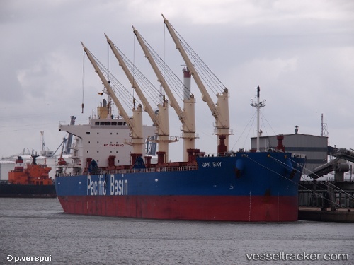
Vessel Oak Bay IMO: 9652557, MMSI: 477832900 Bulk Carrier
UTC, 17.28500, -165.95557, course: 291, speed: 9.6
UTC, 17.42309, -166.33479, course: 290, speed: 9.9
2026-02-24 22:16:39 UTC, 17.54035, -166.68834, course: 285, speed: 10.1
Live AIS position:
UTC. 169 nm E of Johnston Island),
updated 2026-02-24 22:16:39 UTC.
Find the position of the vessel Oak Bay on the map. The latter are known coordinates and path.
marine traffic ship tracker show on live map
The current position of vessel Oak Bay is 17.54035 lat / -166.68834 lng. Updated: 2026-02-24 22:16:39 UTCCurrently sailing under the flag of Hong Kong
Details:
Last coordinates of the vessel:
UTC, 17.16090, -165.59772, course: 292, speed: 9.9UTC, 17.28500, -165.95557, course: 291, speed: 9.6
UTC, 17.42309, -166.33479, course: 290, speed: 9.9
2026-02-24 22:16:39 UTC, 17.54035, -166.68834, course: 285, speed: 10.1