 vesseltracker.com
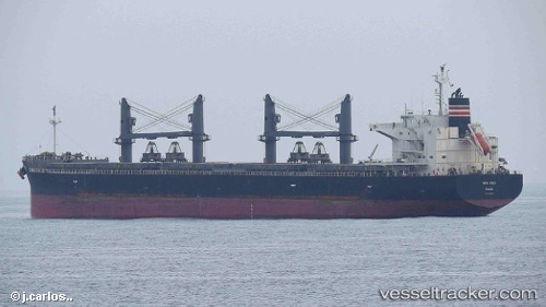
 COVE PEARL
Current Status
Where is the vessel?
COVE PEARL is currently in Near María Chiquita, based on AIS data received about 1h ago.
Latest AIS update:
Current position: 9.49225° N, 79.81839° W (Near María Chiquita)
Average speed (last 7 days): Loading…
Average speed (last 30 days): Loading…
Vessel profile: COVE PEARL is a General Cargo Ship with dimensions 190m x 32m.
This page combines live AIS, route history, probable destination signals, nearby traffic, and port activity for practical vessel monitoring.
The current position of vessel COVE PEARL is 9.49225 lat / -79.81839 lng. Updated: 2026-04-02 12:13:47 UTCNearest reference points:
- Near COLON 2000
- Near Colon
- Near Colón Free Zone
Currently sailing under the flag of Bahamas ![]()
COVE PEARL built in 2014 year
Deadweight:
55889 tDetails:
Live Vessel COVE PEARL Analytics (details, animations, etc.)
Recent AIS points (UTC):
2026-04-02 06:01:37 UTC · 9.49206, -79.81815 · SOG 0.1 kn · COG 41°2026-04-02 08:22:26 UTC · 9.49204, -79.81817 · SOG 0 kn · COG 39°
2026-04-02 09:49:26 UTC · 9.49227, -79.81844 · SOG 0.1 kn · COG 49°
2026-04-02 12:13:47 UTC · 9.49225, -79.81839 · SOG 0.1 kn · COG 42°