 vesseltracker.com
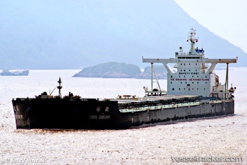
 Cape Europe
Current Status
Where is the vessel?
Cape Europe is currently in 17 nm NW of Pointe des Galets, based on AIS data received about 1h ago.
Latest AIS update:
Current position: 20.79026° S, 55.01564° E (17 nm NW of Pointe des Galets)
Average speed (last 7 days): Loading…
Average speed (last 30 days): Loading…
Vessel profile: Cape Europe is a Bulk Carrier with dimensions 300m x 48m.
This page combines live AIS, route history, probable destination signals, nearby traffic, and port activity for practical vessel monitoring.
The current position of vessel Cape Europe is -20.79026 lat / 55.01564 lng. Updated: 2026-04-15 03:27:53 UTCNearest reference points:
- Near Port Louis
Currently sailing under the flag of Singapore ![]()
Details:
Live Vessel Cape Europe Analytics (details, animations, etc.)
Recent AIS points (UTC):
2026-04-14 22:06:24 UTC · -20.26807, 56.07211 · SOG 12.6 kn · COG 244°2026-04-15 00:04:13 UTC · -20.44830, 55.67461 · SOG 12.7 kn · COG 240°
2026-04-15 01:24:13 UTC · -20.57888, 55.41462 · SOG 12.6 kn · COG 240°
2026-04-15 03:27:53 UTC · -20.79026, 55.01564 · SOG 12.5 kn · COG 236°