 vesseltracker.com
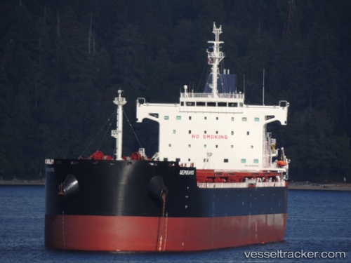
 Semiramis
Current Status
Where is the vessel?
Semiramis is currently in Near GANGAVARAM, based on AIS data received less than 1h ago.
Latest AIS update:
Current position: 17.62045° N, 83.23794° E (Near GANGAVARAM)
Average speed (last 7 days): Loading…
Average speed (last 30 days): Loading…
Vessel profile: Semiramis is a Bulk Carrier with dimensions 229m x 229m.
This page combines live AIS, route history, probable destination signals, nearby traffic, and port activity for practical vessel monitoring.
The current position of vessel Semiramis is 17.62045 lat / 83.23794 lng. Updated: 2026-04-03 07:20:49 UTCNearest reference points:
- Near Vishakhapatnam
- Near Wipro Sez/Resapuvanipalem
- Near Gopalpur
Currently sailing under the flag of Liberia ![]()
Semiramis built in 2013 year
Deadweight:
82620 tDetails:
Live Vessel Semiramis Analytics (details, animations, etc.)
Recent AIS points (UTC):
2026-04-03 01:39:03 UTC · 17.60764, 83.29163 · SOG 0.3 kn · COG 215°2026-04-03 03:33:01 UTC · 17.60577, 83.29288 · SOG 0.9 kn · COG 261°
2026-04-03 05:56:45 UTC · 17.62043, 83.23797 · SOG 0 kn · COG 58°
2026-04-03 07:20:49 UTC · 17.62045, 83.23794 · SOG 0 kn · COG 59°