 vesseltracker.com
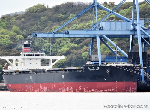
 Hokuriku Maru
Current Status
Where is the vessel?
Hokuriku Maru is currently in 21 nm S of ZHOUSHAN, based on AIS data received about 1h ago.
Latest AIS update:
Current position: 29.62587° N, 122.30550° E (21 nm S of ZHOUSHAN)
Average speed (last 7 days): Loading…
Average speed (last 30 days): Loading…
Vessel profile: Hokuriku Maru is a Bulk Carrier with dimensions 235m x 235m.
This page combines live AIS, route history, probable destination signals, nearby traffic, and port activity for practical vessel monitoring.
The current position of vessel Hokuriku Maru is 29.62587 lat / 122.30550 lng. Updated: 2026-04-05 05:43:01 UTCNearest reference points:
- 20 nm E of Shipu
- 12 nm SE of ZHOUSHAN
- 11 nm S of ZHOUSHAN
Currently sailing under the flag of Japan ![]()
Details:
Live Vessel Hokuriku Maru Analytics (details, animations, etc.)
Recent AIS points (UTC):
2026-04-05 00:09:59 UTC · 29.62350, 122.30080 · SOG 0 kn · COG 85°2026-04-05 01:21:57 UTC · 29.62577, 122.30201 · SOG 0 kn · COG 154°
2026-04-05 03:55:02 UTC · 29.62661, 122.30372 · SOG 0.1 kn · COG 184°
2026-04-05 05:43:01 UTC · 29.62587, 122.30550 · SOG 0.1 kn · COG 232°