 vesseltracker.com
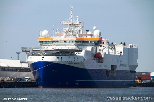
 AMAZON WARRIOR
Current Status
Where is the vessel?
AMAZON WARRIOR is currently in 134 nm E of Charlotteville, based on AIS data received less than 1h ago.
Latest AIS update:
Current position: 11.08916° N, 58.28213° W (134 nm E of Charlotteville)
Average speed (last 7 days): Loading…
Average speed (last 30 days): Loading…
Vessel profile: AMAZON WARRIOR is a Research/Survey Vessel with dimensions m x m.
This page combines live AIS, route history, probable destination signals, nearby traffic, and port activity for practical vessel monitoring.
The current position of vessel AMAZON WARRIOR is 11.08916 lat / -58.28213 lng. Updated: 2026-04-22 11:44:30 UTCNearest reference points:
- Near Saint Michael
- 16 nm E of Galeota Point
Currently sailing under the flag of Bahamas ![]()
Details:
Live Vessel AMAZON WARRIOR Analytics (details, animations, etc.)
Recent AIS points (UTC):
2026-04-22 08:00:33 UTC · 11.20130, -58.48555 · SOG 3.6 kn · COG 108°2026-04-22 10:12:25 UTC · 11.13333, -58.36333 · SOG 3 kn · COG -1°
2026-04-22 10:32:26 UTC · 11.12419, -58.34551 · SOG 3.7 kn · COG 114°
2026-04-22 11:44:30 UTC · 11.08916, -58.28213 · SOG 3.4 kn · COG 107°