 vesseltracker.com
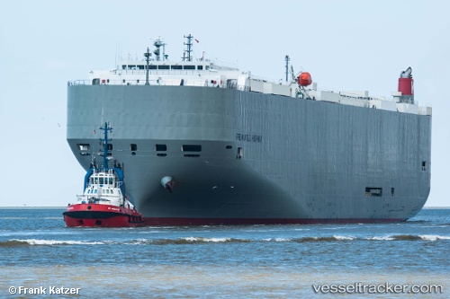
 Fremantle Highway
Current Status
Where is the vessel?
Fremantle Highway is currently in 16 nm NE of Terschelling, based on AIS data received about 979d ago.
Latest AIS update:
Current position: 53.63631° N, 5.56395° E (16 nm NE of Terschelling)
Average speed (last 7 days): Loading…
Average speed (last 30 days): Loading…
Vessel profile: Fremantle Highway is a Vehicles Carrier with dimensions 199m x 199m.
This page combines live AIS, route history, probable destination signals, nearby traffic, and port activity for practical vessel monitoring.
The current position of vessel Fremantle Highway is 53.63631 lat / 5.56395 lng. Updated: 2023-07-26 11:12:12 UTCNearest reference points:
- Near FRANEKER
- Near HARLINGEN
- 14 nm NW of Town Quays/Drogheda
Currently sailing under the flag of Panama ![]()
Details:
Live Vessel Fremantle Highway Analytics (details, animations, etc.)
Recent AIS points (UTC):
2023-07-26 11:12:12 UTC · 53.63631, 5.56395 · SOG 0.1 kn · COG 94°