 vesseltracker.com
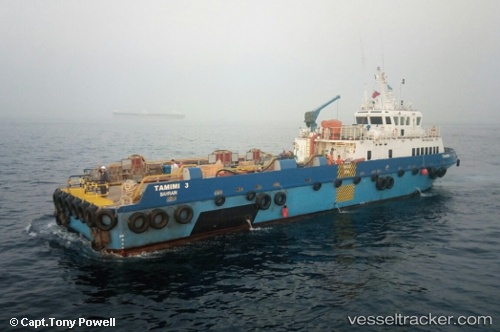
 TAMIMI 3
Current Status
Where is the vessel?
TAMIMI 3 is currently in 29 nm E of Bandar Al Mishab, based on AIS data received about 3h ago.
Latest AIS update:
Current position: 28.24102° N, 49.24302° E (29 nm E of Bandar Al Mishab)
Average speed (last 7 days): Loading…
Average speed (last 30 days): Loading…
Vessel profile: TAMIMI 3 is a Offshore Supply Ship with dimensions 8m x 40m.
This page combines live AIS, route history, probable destination signals, nearby traffic, and port activity for practical vessel monitoring.
The current position of vessel TAMIMI 3 is 28.24102 lat / 49.24302 lng. Updated: 2026-04-03 10:32:24 UTCNearest reference points:
- 26 nm E of Bandar Al Mishab
- 29 nm E of Bandar Al Mishab
- 31 nm S of Soroosh (Cyrus) Terminal
Currently sailing under the flag of Saudi Arabia ![]()
TAMIMI 3 built in 2013 year
Deadweight:
81 tDetails:
Live Vessel TAMIMI 3 Analytics (details, animations, etc.)
Recent AIS points (UTC):
2026-04-03 06:04:48 UTC · 28.24442, 49.33801 · SOG 11.6 kn · COG 255°2026-04-03 07:42:21 UTC · 28.31731, 49.04883 · SOG 11.6 kn · COG 320°
2026-04-03 09:52:16 UTC · 28.24864, 49.17616 · SOG 11.4 kn · COG 103°
2026-04-03 10:32:24 UTC · 28.24102, 49.24302 · SOG 11.4 kn · COG -1°