 vesseltracker.com
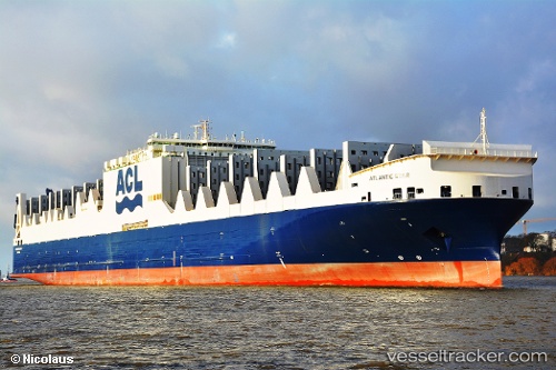
 ATLANTIC STAR
Current Status
Where is the vessel?
ATLANTIC STAR is currently in 65 nm SW of Schönheide, based on AIS data received about 7h ago.
Latest AIS update:
Current position: 49.93960° N, 13.97520° W (65 nm SW of Schönheide)
Average speed (last 7 days): Loading…
Average speed (last 30 days): Loading…
Vessel profile: ATLANTIC STAR is a Container Ro-Ro Cargo Ship with dimensions 296m x 38m.
This page combines live AIS, route history, probable destination signals, nearby traffic, and port activity for practical vessel monitoring.
The current position of vessel ATLANTIC STAR is 49.9396 lat / -13.9752 lng. Updated: 2026-03-26 03:04:09 UTCNearest reference points:
- 24 nm N of Aurach Bei Kitzbuhel
- 20 nm SE of Wunschendorf
Currently sailing under the flag of Malta ![]()
ATLANTIC STAR built in 2015 year
Deadweight:
55649 tDetails:
Live Vessel ATLANTIC STAR Analytics (details, animations, etc.)
Recent AIS points (UTC):
2026-03-26 01:34:18 UTC · 50.08910, -13.44540 · SOG 14.6 kn · COG 246°2026-03-26 03:04:09 UTC · 49.93960, -13.97520 · SOG 14.9 kn · COG 243°
2026-03-26 03:04:09 UTC · 49.93960, -13.97520 · SOG 14.9 kn · COG 243°
2026-03-26 03:04:09 UTC · 49.93960, -13.97520 · SOG 14.9 kn · COG 243°