 vesseltracker.com
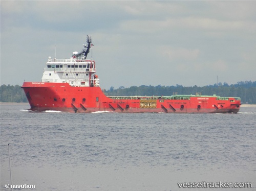
 Executive Tide
Current Status
Where is the vessel?
Executive Tide is currently in 170 nm W of Armenia, based on AIS data received less than 1h ago.
Latest AIS update:
Current position: 13.97289° N, 86.57982° E (170 nm W of Armenia)
Average speed (last 7 days): Loading…
Average speed (last 30 days): Loading…
Vessel profile: Executive Tide is a Offshore Tug Supply Ship with dimensions 78m x 78m.
This page combines live AIS, route history, probable destination signals, nearby traffic, and port activity for practical vessel monitoring.
The current position of vessel Executive Tide is 13.97289 lat / 86.57982 lng. Updated: 2026-04-18 19:34:35 UTCCurrently sailing under the flag of Malaysia ![]()
Details:
Live Vessel Executive Tide Analytics (details, animations, etc.)
Recent AIS points (UTC):
2026-04-18 14:17:58 UTC · 14.53500, 85.85833 · SOG 9 kn · COG -1°2026-04-18 15:50:51 UTC · 14.37667, 86.07333 · SOG 10 kn · COG -1°
2026-04-18 18:08:55 UTC · 14.13667, 86.39500 · SOG 10 kn · COG -1°
2026-04-18 19:34:35 UTC · 13.97289, 86.57982 · SOG 10.2 kn · COG 118°