 vesseltracker.com
 MAMA STRENGTH
Current Status
Where is the vessel?
MAMA STRENGTH is currently in 11 nm N of Nurme, based on AIS data received less than 1h ago.
Latest AIS update:
Current position: 59.76441° N, 24.75974° E (11 nm N of Nurme)
Average speed (last 7 days): Loading…
Average speed (last 30 days): Loading…
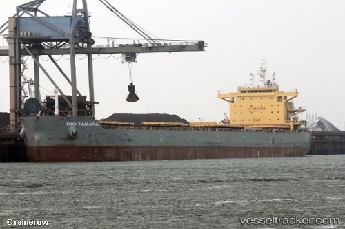
Vessel profile: MAMA STRENGTH is a Bulk Carrier with dimensions 32m x 225m.
This page combines live AIS, route history, probable destination signals, nearby traffic, and port activity for practical vessel monitoring.
The current position of vessel MAMA STRENGTH is 59.76441 lat / 24.75974 lng. Updated: 2026-04-18 16:28:33 UTCNearest reference points:
- Near Nurme
- Near Aegna
- Near Vanasadam
Currently sailing under the flag of Marshall Islands ![]()
MAMA STRENGTH built in 2014 year
Deadweight:
75610 tDetails:
Live Vessel MAMA STRENGTH Analytics (details, animations, etc.)
Recent AIS points (UTC):
2026-04-18 09:39:02 UTC · 59.31882, 22.33145 · SOG 11.5 kn · COG 58°2026-04-18 11:57:40 UTC · 59.50893, 23.10302 · SOG 11.5 kn · COG 71°
2026-04-18 14:01:21 UTC · 59.63695, 23.85741 · SOG 11.7 kn · COG 73°
2026-04-18 16:28:33 UTC · 59.76441, 24.75974 · SOG 11.6 kn · COG 77°