 vesseltracker.com
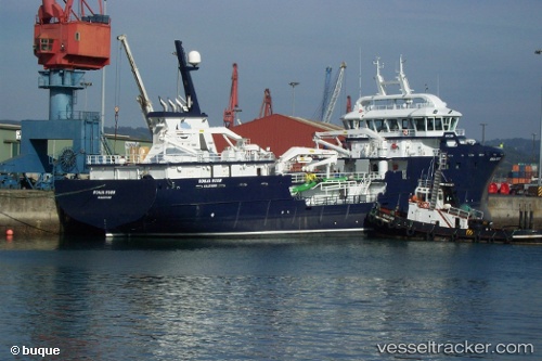
 Ronja Huon
Current Status
Where is the vessel?
Ronja Huon is currently in Near Glaziers Bay, based on AIS data received less than 1h ago.
Latest AIS update:
Current position: 43.15952° S, 146.97565° E (Near Glaziers Bay)
Average speed (last 7 days): Loading…
Average speed (last 30 days): Loading…
Vessel profile: Ronja Huon is a Fish Carrier with dimensions 76m x 16m.
This page combines live AIS, route history, probable destination signals, nearby traffic, and port activity for practical vessel monitoring.
The current position of vessel Ronja Huon is -43.15952 lat / 146.97565 lng. Updated: 2026-04-21 00:59:56 UTCNearest reference points:
- Near BLUNY ISLAND
- Near Hobart
- Near LINDISFARNE
Currently sailing under the flag of Norway ![]()
Ronja Huon built in 2014 year
Deadweight:
3800 tDetails:
Live Vessel Ronja Huon Analytics (details, animations, etc.)
Recent AIS points (UTC):
2026-04-20 21:33:48 UTC · -43.19387, 146.98030 · SOG 7 kn · COG 305°2026-04-20 22:23:55 UTC · -43.15951, 146.97565 · SOG 0 kn · COG 359°
2026-04-20 23:20:54 UTC · -43.15957, 146.97566 · SOG 0 kn · COG 0°
2026-04-21 00:59:56 UTC · -43.15952, 146.97565 · SOG 0 kn · COG 0°