 vesseltracker.com
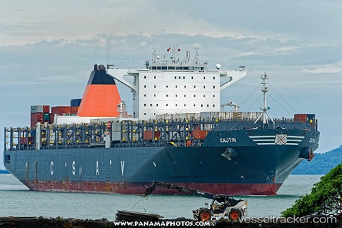
Cautin
Current StatusWhere is the vessel?
Cautin is currently in 144 nm SW of Xijiang, based on AIS data received about 1h ago.
Latest AIS update:
Current position: 19.16500° N, 113.67333° E (144 nm SW of Xijiang)
Average speed (last 7 days): Loading…
Average speed (last 30 days): Loading…
Vessel profile: Cautin is a Container Ship with dimensions 48m x 300m.
This page combines live AIS, route history, probable destination signals, nearby traffic, and port activity for practical vessel monitoring.
The current position of vessel Cautin is 19.16500 lat / 113.67333 lng. Updated: 2026-04-18 01:40:10 UTCNearest reference points:
- 123 nm S of Shadi
- 78 nm SW of Xijiang
- 60 nm SE of Shadi
Details:
Live Vessel Cautin Analytics (details, animations, etc.)
Recent AIS points (UTC):
2026-04-17 19:49:02 UTC · 20.43853, 114.17713 · SOG 15.9 kn · COG 202°2026-04-17 20:55:09 UTC · 20.21833, 113.98500 · SOG 15 kn · COG -1°
2026-04-17 23:31:13 UTC · 19.60667, 113.73833 · SOG 16 kn · COG -1°
2026-04-18 01:40:10 UTC · 19.16500, 113.67333 · SOG 8 kn · COG -1°