 vesseltracker.com
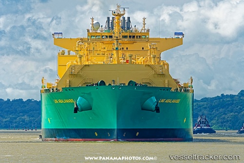
Lng Abalamabie
Current StatusWhere is the vessel?
Lng Abalamabie is currently in 143 nm SW of Koiingnaas, based on AIS data received less than 1h ago.
Latest AIS update:
Current position: 31.12643° S, 14.73480° E (143 nm SW of Koiingnaas)
Average speed (last 7 days): Loading…
Average speed (last 30 days): Loading…
Vessel profile: Lng Abalamabie is a Lng Tanker with dimensions 48m x 292m.
This page combines live AIS, route history, probable destination signals, nearby traffic, and port activity for practical vessel monitoring.
The current position of vessel Lng Abalamabie is -31.12643 lat / 14.73480 lng. Updated: 2026-04-08 05:59:48 UTCNearest reference points:
- 154 nm W of Koiingnaas
- 167 nm SW of Koiingnaas
- 161 nm W of Koiingnaas
Details:
Live Vessel Lng Abalamabie Analytics (details, animations, etc.)
Recent AIS points (UTC):
2026-04-08 00:03:49 UTC · -32.15284, 15.26208 · SOG 11.2 kn · COG 306°2026-04-08 01:45:18 UTC · -31.90836, 15.05182 · SOG 11.3 kn · COG 341°
2026-04-08 03:22:09 UTC · -31.61081, 14.94768 · SOG 11.6 kn · COG 341°
2026-04-08 05:59:48 UTC · -31.12643, 14.73480 · SOG 11.8 kn · COG 340°