 vesseltracker.com
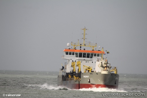
 Freeway
Current Status
Where is the vessel?
Freeway is currently in Near Waterford Great Island (ESB), based on AIS data received about 1h ago.
Latest AIS update:
Current position: 52.25704° N, 6.99627° W (Near Waterford Great Island (ESB))
Average speed (last 7 days): Loading…
Average speed (last 30 days): Loading…
Vessel profile: Freeway is a Hopper Dredger with dimensions 92m x 92m.
This page combines live AIS, route history, probable destination signals, nearby traffic, and port activity for practical vessel monitoring.
The current position of vessel Freeway is 52.25704 lat / -6.99627 lng. Updated: 2026-04-17 15:55:09 UTCNearest reference points:
- Near WEXFORD
- Near HELVICK
- Near ARKLOW
Currently sailing under the flag of Cyprus ![]()
Details:
Live Vessel Freeway Analytics (details, animations, etc.)
Recent AIS points (UTC):
2026-04-17 09:52:20 UTC · 52.25413, -6.99666 · SOG 10.3 kn · COG 162°2026-04-17 11:49:00 UTC · 52.24642, -6.98557 · SOG 10.4 kn · COG 304°
2026-04-17 13:31:51 UTC · 52.16683, -6.94040 · SOG 7.8 kn · COG 184°
2026-04-17 15:55:09 UTC · 52.25704, -6.99627 · SOG 7.6 kn · COG 176°