 vesseltracker.com
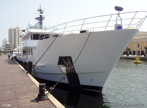
Batai
Current StatusWhere is the vessel?
Batai is currently in Near Ixtapa/Zihuatanejo, based on AIS data received about 1h ago.
Latest AIS update:
Current position: 17.66062° N, 101.62452° W (Near Ixtapa/Zihuatanejo)
Average speed (last 7 days): Loading…
Average speed (last 30 days): Loading…
Vessel profile: Batai is a Service Ship with dimensions 8m x 38m.
This page combines live AIS, route history, probable destination signals, nearby traffic, and port activity for practical vessel monitoring.
The current position of vessel Batai is 17.66062 lat / -101.62452 lng. Updated: 2026-04-04 05:14:36 UTCNearest reference points:
- Near Ixtapa/Zihuatanejo
- Near Lazaro Cardenas
- 43 nm SW of Antunez
Details:
Live Vessel Batai Analytics (details, animations, etc.)
Recent AIS points (UTC):
2026-04-03 22:59:33 UTC · 17.66101, -101.62409 · SOG 0.4 kn · COG 244°2026-04-04 01:20:55 UTC · 17.66072, -101.62425 · SOG 0.3 kn · COG 274°
2026-04-04 02:57:38 UTC · 17.66068, -101.62457 · SOG 0.3 kn · COG 277°
2026-04-04 05:14:36 UTC · 17.66062, -101.62452 · SOG 0.5 kn · COG 296°