 vesseltracker.com
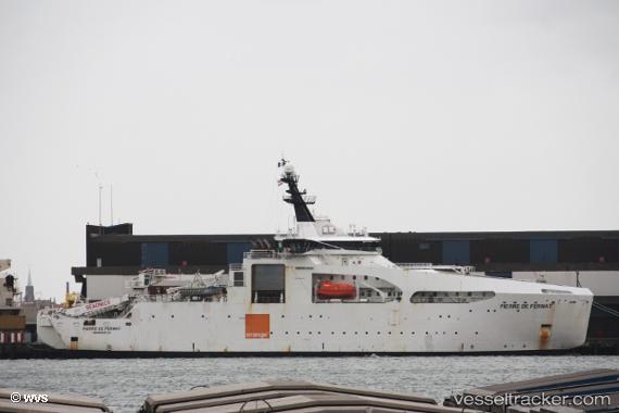
 Pierre De Fermat
Current Status
Where is the vessel?
Pierre De Fermat is currently in 12 nm E of Craven Arms, based on AIS data received about 1h ago.
Latest AIS update:
Current position: 52.47103° N, 3.15659° E (12 nm E of Craven Arms)
Average speed (last 7 days): Loading…
Average speed (last 30 days): Loading…
Vessel profile: Pierre De Fermat is a Cable Layer with dimensions 100m x 21m.
This page combines live AIS, route history, probable destination signals, nearby traffic, and port activity for practical vessel monitoring.
The current position of vessel Pierre De Fermat is 52.47103 lat / 3.15659 lng. Updated: 2026-04-07 16:22:01 UTCNearest reference points:
- Near Craven Arms
- Near Hunsdon
- 21 nm S of Craven Arms
Currently sailing under the flag of France ![]()
Details:
Live Vessel Pierre De Fermat Analytics (details, animations, etc.)
Recent AIS points (UTC):
2026-04-07 10:22:30 UTC · 52.47058, 3.15492 · SOG 0.2 kn · COG 55°2026-04-07 12:02:10 UTC · 52.47073, 3.15480 · SOG 0.3 kn · COG 56°
2026-04-07 14:13:50 UTC · 52.47152, 3.15202 · SOG 0.2 kn · COG 54°
2026-04-07 16:22:01 UTC · 52.47103, 3.15659 · SOG 0.2 kn · COG 59°