 vesseltracker.com
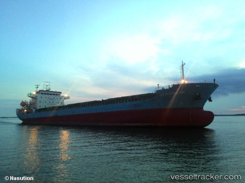
Intan Daya 368
Current StatusWhere is the vessel?
Intan Daya 368 is currently in Near BATU AMPAR, based on AIS data received about 2h ago.
Latest AIS update:
Current position: 1.22744° N, 104.07304° E (Near BATU AMPAR)
Average speed (last 7 days): Loading…
Average speed (last 30 days): Loading…
Vessel profile: Intan Daya 368 is a General Cargo Ship with dimensions 27m x 122m.
This page combines live AIS, route history, probable destination signals, nearby traffic, and port activity for practical vessel monitoring.
The current position of vessel Intan Daya 368 is 1.22744 lat / 104.07304 lng. Updated: 2026-03-28 05:57:10 UTCNearest reference points:
- Near TANAH MERAH
- Near BATU AMPAR
- Near Changi
Details:
Live Vessel Intan Daya 368 Analytics (details, animations, etc.)
Recent AIS points (UTC):
2026-03-27 23:12:02 UTC · 1.28667, 104.49500 · SOG 4 kn · COG -1°2026-03-28 01:35:18 UTC · 1.23843, 104.33292 · SOG 5 kn · COG -1°
2026-03-28 04:00:48 UTC · 1.22951, 104.12200 · SOG 5 kn · COG 261°
2026-03-28 05:57:10 UTC · 1.22744, 104.07304 · SOG 2.1 kn · COG 272°