 vesseltracker.com
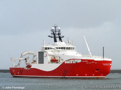
Seaway Aimery
Current StatusWhere is the vessel?
Seaway Aimery is currently in Near Amsterdam, based on AIS data received about 1h ago.
Latest AIS update:
Current position: 52.40779° N, 4.88093° E (Near Amsterdam)
Average speed (last 7 days): Loading…
Average speed (last 30 days): Loading…
Vessel profile: Seaway Aimery is a Cable Layer with dimensions 21m x 95m.
This page combines live AIS, route history, probable destination signals, nearby traffic, and port activity for practical vessel monitoring.
The current position of vessel Seaway Aimery is 52.40779 lat / 4.88093 lng. Updated: 2026-03-28 05:22:48 UTCNearest reference points:
- Near Amsterdam
- Near ZAANDAM
- Near Zaanstad
Details:
Live Vessel Seaway Aimery Analytics (details, animations, etc.)
Recent AIS points (UTC):
2026-03-27 23:34:57 UTC · 52.40779, 4.88093 · SOG 0 kn · COG -1°2026-03-28 02:05:10 UTC · 52.40779, 4.88093 · SOG 0 kn · COG -1°
2026-03-28 03:35:17 UTC · 52.40779, 4.88093 · SOG 0 kn · COG -1°
2026-03-28 05:22:48 UTC · 52.40779, 4.88093 · SOG 0 kn · COG -1°