 vesseltracker.com
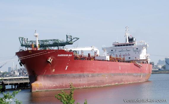
Harrison Bay
Current StatusWhere is the vessel?
Harrison Bay is currently in Open sea (no nearby ports in database), based on AIS data received about 1h ago.
Latest AIS update:
Current position: 4.71025° N, 60.59522° E (Open sea (no nearby ports in database))
Average speed (last 7 days): Loading…
Average speed (last 30 days): Loading…
Vessel profile: Harrison Bay is a Chemical Oil Products Tanker with dimensions 32m x 183m.
This page combines live AIS, route history, probable destination signals, nearby traffic, and port activity for practical vessel monitoring.
The current position of vessel Harrison Bay is 4.71025 lat / 60.59522 lng. Updated: 2026-04-13 08:01:55 UTCNearest reference points:
- Open sea (no nearby ports in database)
Details:
Live Vessel Harrison Bay Analytics (details, animations, etc.)
Recent AIS points (UTC):
2026-04-12 23:30:05 UTC · 3.01363, 59.56661 · SOG 13.6 kn · COG 38°2026-04-13 03:27:20 UTC · 3.77321, 60.07696 · SOG 13.8 kn · COG 28°
2026-04-13 05:36:34 UTC · 4.21286, 60.31933 · SOG 14 kn · COG 29°
2026-04-13 08:01:55 UTC · 4.71025, 60.59522 · SOG 13.9 kn · COG 38°