 vesseltracker.com
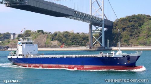
Hakkoumaru
Current StatusWhere is the vessel?
Hakkoumaru is currently in Near Tokuyama, based on AIS data received about 1h ago.
Latest AIS update:
Current position: 33.90601° N, 131.66557° E (Near Tokuyama)
Average speed (last 7 days): Loading…
Average speed (last 30 days): Loading…
Vessel profile: Hakkoumaru is a General Cargo Ship with dimensions 13m x 85m.
This page combines live AIS, route history, probable destination signals, nearby traffic, and port activity for practical vessel monitoring.
The current position of vessel Hakkoumaru is 33.90601 lat / 131.66557 lng. Updated: 2026-04-16 23:39:13 UTCNearest reference points:
- 13 nm S of NAKANOSEKI
- Near Tokuyama
- Near KUDAMATSU
Details:
Live Vessel Hakkoumaru Analytics (details, animations, etc.)
Recent AIS points (UTC):
2026-04-16 14:50:24 UTC · 33.95649, 131.92740 · SOG 0 kn · COG -1°2026-04-16 16:10:32 UTC · 33.95647, 131.92738 · SOG 0 kn · COG -1°
2026-04-16 21:31:22 UTC · 33.95646, 131.92738 · SOG 0 kn · COG 356°
2026-04-16 23:39:13 UTC · 33.90601, 131.66557 · SOG 12.2 kn · COG 264°