 vesseltracker.com
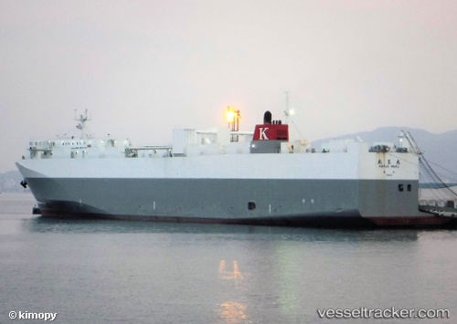
Hokuo Maru
Current StatusWhere is the vessel?
Hokuo Maru is currently in Near Tomakomai, based on AIS data received less than 1h ago.
Latest AIS update:
Current position: 42.52414° N, 141.59140° E (Near Tomakomai)
Average speed (last 7 days): Loading…
Average speed (last 30 days): Loading…
Vessel profile: Hokuo Maru is a Vehicles Carrier with dimensions 27m x 173m.
This page combines live AIS, route history, probable destination signals, nearby traffic, and port activity for practical vessel monitoring.
The current position of vessel Hokuo Maru is 42.52414 lat / 141.59140 lng. Updated: 2026-04-06 13:56:08 UTCNearest reference points:
- Near Muroran
- 23 nm NE of SAI
- 11 nm NW of Yokohama, Aomori
Details:
Live Vessel Hokuo Maru Analytics (details, animations, etc.)
Recent AIS points (UTC):
2026-04-06 05:40:59 UTC · 42.63808, 141.62329 · SOG 0 kn · COG 156°2026-04-06 09:52:59 UTC · 42.63804, 141.62331 · SOG 0 kn · COG 155°
2026-04-06 12:13:59 UTC · 42.63805, 141.62326 · SOG 0 kn · COG 155°
2026-04-06 13:56:08 UTC · 42.52414, 141.59140 · SOG 17.7 kn · COG 190°