 vesseltracker.com
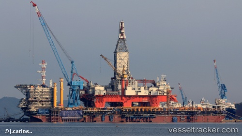
 Fpu Likouf
Current Status
Where is the vessel?
Fpu Likouf is currently in 11 nm NW of Kuito Terminal, based on AIS data received about 2h ago.
Latest AIS update:
Current position: 5.28548° S, 11.38420° E (11 nm NW of Kuito Terminal)
Average speed (last 7 days): Loading…
Average speed (last 30 days): Loading…
Vessel profile: Fpu Likouf is a General Cargo Ship with dimensions 250m x 44m.
This page combines live AIS, route history, probable destination signals, nearby traffic, and port activity for practical vessel monitoring.
The current position of vessel Fpu Likouf is -5.28548 lat / 11.38420 lng. Updated: 2026-04-22 17:09:17 UTCNearest reference points:
- Near N'Kossa Terminal
- 11 nm W of Cabinda
- Near Pointe Noire
Currently sailing under the flag of Liberia ![]()
Details:
Live Vessel Fpu Likouf Analytics (details, animations, etc.)
Recent AIS points (UTC):
2026-04-22 14:05:08 UTC · -5.28548, 11.38420 · SOG 0.1 kn · COG 27°2026-04-22 16:20:06 UTC · -5.28548, 11.38420 · SOG 0.1 kn · COG 27°
2026-04-22 16:20:06 UTC · -5.28548, 11.38420 · SOG 0.1 kn · COG 27°
2026-04-22 17:09:17 UTC · -5.28548, 11.38420 · SOG 0.6 kn · COG -1°