 vesseltracker.com
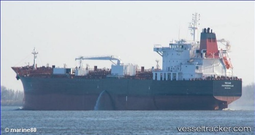
 Texas
Texas
Current Status
Where is the vessel?
Texas is currently in Near Anacortes, based on AIS data received less than 1h ago.
Latest AIS update:
Current position: 48.50888° N, 122.57043° W (Near Anacortes)
Average speed (last 7 days): Loading…
Average speed (last 30 days): Loading…
Vessel profile: Texas is a Chemical Oil Products Tanker with dimensions 183m x 32m.
This page combines live AIS, route history, probable destination signals, nearby traffic, and port activity for practical vessel monitoring.
The current position of vessel Texas is 48.50888 lat / -122.57043 lng. Updated: 2026-04-21 07:49:18 UTCNearest reference points:
- Near Anacortes
- Near Bellingham
- Near ORCAS
Currently sailing under the flag of USA ![]()
Details:
Live Vessel Texas Analytics (details, animations, etc.)
Recent AIS points (UTC):
2026-04-21 04:55:18 UTC · 48.50887, -122.57035 · SOG 0 kn · COG 100°2026-04-21 05:22:21 UTC · 48.50888, -122.57040 · SOG 0 kn · COG 101°
2026-04-21 07:25:17 UTC · 48.50888, -122.57037 · SOG 0 kn · COG 100°
2026-04-21 07:49:18 UTC · 48.50888, -122.57043 · SOG 0 kn · COG 100°