 vesseltracker.com
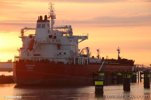
 VUKOVAR
Current Status
Where is the vessel?
VUKOVAR is currently in Near Puerto Barrios, based on AIS data received less than 1h ago.
Latest AIS update:
Current position: 15.73460° N, 88.60960° W (Near Puerto Barrios)
Average speed (last 7 days): Loading…
Average speed (last 30 days): Loading…
Vessel profile: VUKOVAR is a Chemical/Oil Products Tanker with dimensions 183m x 32m.
This page combines live AIS, route history, probable destination signals, nearby traffic, and port activity for practical vessel monitoring.
The current position of vessel VUKOVAR is 15.7346 lat / -88.6096 lng. Updated: 2026-04-04 23:51:54 UTCNearest reference points:
- 14 nm NW of Puerto Cortes
- 12 nm SW of Dangriga
- 26 nm SE of Dangriga
Currently sailing under the flag of Malta ![]()
VUKOVAR built in 2015 year
Deadweight:
49990 tDetails:
Live Vessel VUKOVAR Analytics (details, animations, etc.)
Recent AIS points (UTC):
2026-04-04 17:45:57 UTC · 15.73470, -88.60960 · SOG 0 kn · COG 94°2026-04-04 19:48:53 UTC · 15.73470, -88.60960 · SOG 0 kn · COG 93°
2026-04-04 21:42:52 UTC · 15.73470, -88.60960 · SOG 0 kn · COG 93°
2026-04-04 23:51:54 UTC · 15.73460, -88.60960 · SOG 0 kn · COG 93°