 vesseltracker.com
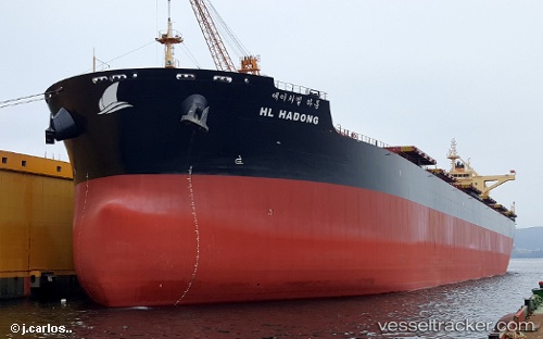
 Hl Hadong
Current Status
Where is the vessel?
Hl Hadong is currently in 26 nm S of Kukdo, based on AIS data received less than 1h ago.
Latest AIS update:
Current position: 34.11595° N, 128.28784° E (26 nm S of Kukdo)
Average speed (last 7 days): Loading…
Average speed (last 30 days): Loading…
Vessel profile: Hl Hadong is a Bulk Carrier with dimensions 273m x 46m.
This page combines live AIS, route history, probable destination signals, nearby traffic, and port activity for practical vessel monitoring.
The current position of vessel Hl Hadong is 34.11595 lat / 128.28784 lng. Updated: 2026-04-07 13:51:10 UTCNearest reference points:
- 25 nm S of Kukdo
- 35 nm E of Geomundo
- 15 nm S of Kukdo
Currently sailing under the flag of Panama ![]()
Details:
Live Vessel Hl Hadong Analytics (details, animations, etc.)
Recent AIS points (UTC):
2026-04-07 08:03:44 UTC · 34.11738, 128.28743 · SOG 0 kn · COG 276°2026-04-07 09:18:44 UTC · 34.11787, 128.28760 · SOG 0 kn · COG 260°
2026-04-07 11:27:57 UTC · 34.11811, 128.28748 · SOG 0 kn · COG -1°
2026-04-07 13:51:10 UTC · 34.11595, 128.28784 · SOG 0 kn · COG -1°